UTM vs Lat/Long vs MGRS: Which Coordinate System Should You Actually Use?
Decimal degrees, UTM, and MGRS describe the same point on Earth but solve different problems. The real structure behind each, and when to use which.
UTM vs Lat/Long vs MGRS: Which Should You Actually Use?
These three systems aren’t competing translations of the same idea — they’re built to solve three different problems. Decimal degrees describe a location on a sphere. UTM projects that location onto a flat grid measured in meters. MGRS compresses UTM into a single, radio-friendly string. Same point on Earth, three genuinely different tools.
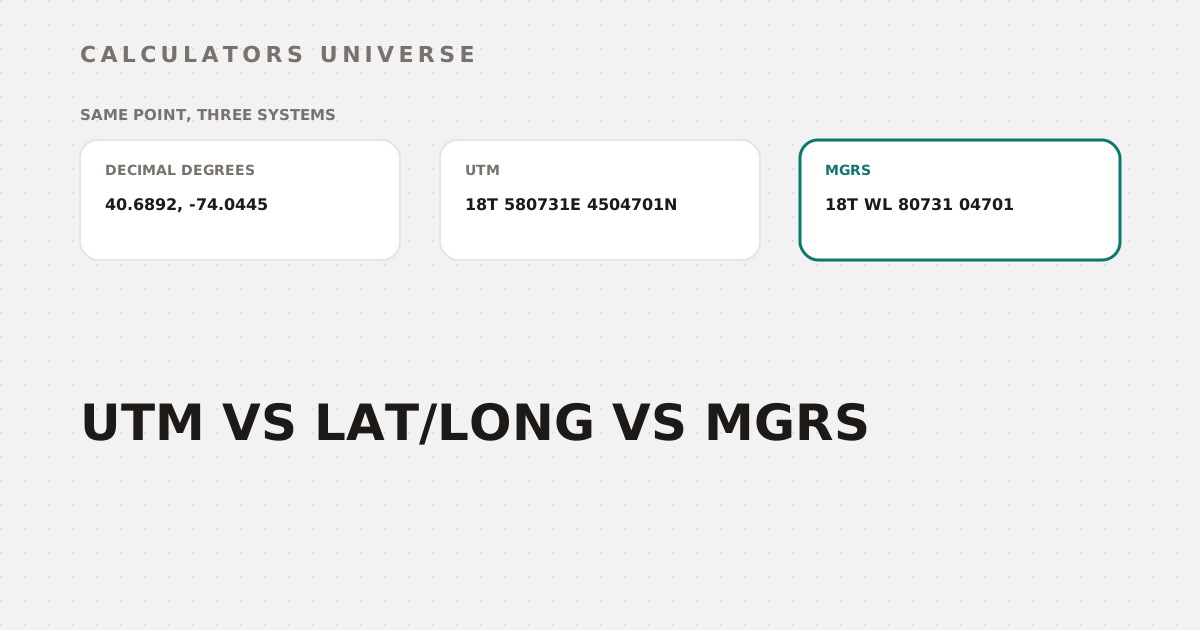
Take one real example: the Statue of Liberty. The same location is:
- Decimal degrees: 40.6892, -74.0445
- UTM: 18T 580731mE, 4504701mN
- MGRS: 18T WL 80731 04701
Here’s what’s actually happening inside each of those strings.
Decimal Degrees: The Universal Default
Decimal degrees (latitude and longitude as signed decimal numbers) are what GPS receivers, Google Maps, and virtually every mapping API expect natively. Precision scales directly with decimal places: 4 decimal places resolves to about 11.1 meters, 5 decimal places to about 1.11 meters, and 6 decimal places to about 11.1 centimeters at the equator. For most web mapping and recreational GPS use, 4-5 decimal places is already more than enough — anything beyond that can overstate how accurate your source data actually is.
If you need to switch between decimal degrees and the classic degrees-minutes-seconds notation surveyors and mariners still use, the Lat/Long to DMS Converter handles that instantly, and the Coordinate Converter moves between DD, DMS, UTM, and MGRS in one tool.
UTM: Built for Measuring in Meters, Not Degrees
Decimal degrees measure angles on a sphere — great for location, bad for measuring distance or area directly, since a degree of longitude covers a different physical distance depending on your latitude. UTM (Universal Transverse Mercator) solves this by projecting the Earth’s surface onto 60 flat zones, each 6° of longitude wide, numbered 1 to 60 starting at the 180° meridian and running east. Coverage runs from 80°S to 84°N — the polar caps beyond that use a separate system (UPS) instead. Inside its zone, UTM gives you a simple easting/northing pair in meters, which means you can calculate distances and areas with ordinary arithmetic instead of spherical trigonometry.
This is exactly why UTM is the default for engineering, land surveying, and any GIS work that needs to measure things, not just locate them. Convert into or out of UTM with the WGS84 to UTM Converter and UTM to Lat/Long Converter, or find which of the 60 zones (and its EPSG code) covers a given coordinate with the UTM Zone Finder.
MGRS: Built for Compactness, Not Just Location
MGRS doesn't replace UTM — it nests inside it: zone, then 100km square, then a precise offset
MGRS (Military Grid Reference System) builds directly on top of UTM rather than replacing it. It combines the UTM zone number with a latitude band letter (bands C through X, skipping I and O, each 8° tall except the northernmost band X at 12°) to form a Grid Zone Designator. Inside that zone, a 100,000-meter grid square gets its own two-letter identifier, and the exact position within that square is given as a numeric offset — 2, 4, 6, 8, or 10 digits, corresponding to 10km, 1km, 100m, 10m, or 1m precision respectively.
The entire point of this structure is compactness: a single string like 18T WL 80731 04701 carries the same positional information as separate zone, easting, and northing fields, but transmits cleanly over radio and is far harder to garble than a long decimal number with a sign and a hemisphere letter attached. That’s exactly why MGRS is the standard for military coordination and increasingly used in emergency response. Batch-convert MGRS strings to WGS84 latitude/longitude with the MGRS to Lat/Long Bulk Converter.
Which Should You Actually Use?
| Task | Best System | Why |
|---|---|---|
| Web maps, GPS apps, sharing a pin | Decimal Degrees | Universal support across every mapping API and device |
| Measuring distance or area on a project | UTM | Flat projection means direct meter-based arithmetic |
| Radio transmission, field coordination, emergency response | MGRS | Most compact single-string format, resistant to transcription errors |
| Legacy paper charts, some survey documentation | DMS | Long-standing convention still used in maritime and older survey records |
Frequently Asked Questions
Is MGRS more accurate than UTM?
No — MGRS uses the same underlying UTM (or UPS, near the poles) projection and the same precision. It’s more compact, not more precise.
Why do militaries use MGRS instead of latitude/longitude?
MGRS packs zone, 100km grid square, and a precise offset into one alphanumeric string that’s short, easy to read aloud, and resistant to transcription errors — properties that matter far more in radio communication than raw decimal precision.
Can Google Maps read MGRS coordinates directly?
No — Google Maps and most consumer mapping tools expect decimal degrees. You’ll need to convert MGRS to lat/long first, which the MGRS to Lat/Long Bulk Converter does directly.
How many UTM zones are there, and how wide is each one?
60 zones, each spanning 6° of longitude, numbered 1 through 60 starting at the 180° meridian and running east. Coverage runs from 80°S to 84°N, with the polar regions handled by a separate system (UPS).
What’s the difference between UTM and DMS (degrees-minutes-seconds)?
DMS is still an angular geographic format like decimal degrees, just expressed in base-60 minutes and seconds instead of a decimal fraction — it doesn’t project onto a flat grid the way UTM does, so it shares UTM’s advantages for measurement or radio use.
Related Calculators
Start with the Coordinate Converter for quick conversions between all four formats, use the WGS84 to UTM Converter and UTM to Lat/Long Converter for projected coordinate work, find your zone and EPSG code with the UTM Zone Finder, batch-convert military grid references with the MGRS to Lat/Long Bulk Converter, and switch between decimal and DMS notation with the Lat/Long to DMS Converter.
External Resources
- Universal Transverse Mercator coordinate system — Wikipedia — background on UTM zone structure and projection
- Military Grid Reference System — Wikipedia — full technical reference for MGRS grid zone designators and precision